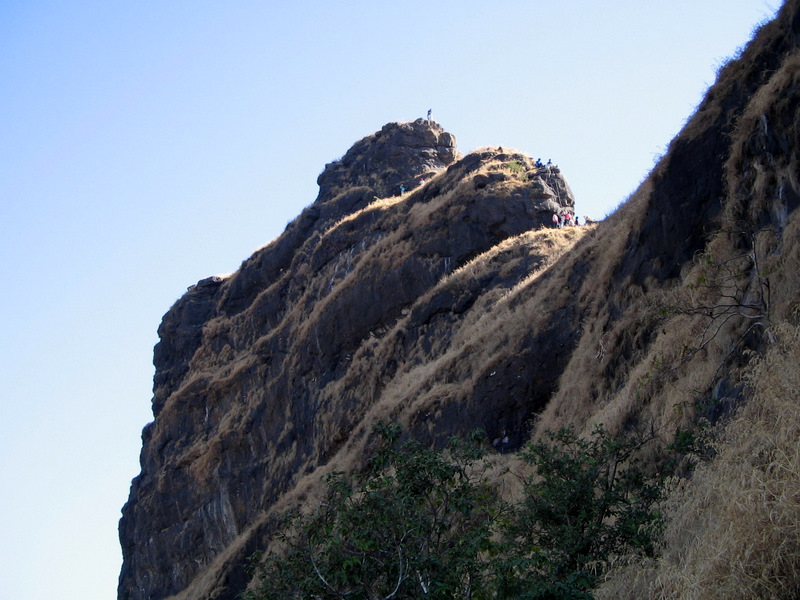
Irshalgad is a sharp rock pinnacle on a plateau between Panvel and Karjat in Raigad district, between Prabalgad and Matheran. It is less a built fort than a natural citadel, with rock-cut steps and cisterns on the way up to its needle-like summit.
Know before you go
- Location
- Between Panvel and Karjat, Raigad district
- Start point
- Chowk village, then Nanivali
- Trek time
- About 2.5–3 hours to the pinnacle base
- Difficulty
- Moderate to the base; pinnacle is a technical climb
- Gear
- Ropes and an experienced team for the pinnacle
- Note
- Check access: the Irshalwadi area was hit by a landslide in July 2023
- Best time
- October to February
Overview
The walk to the base of the pinnacle is moderate, and the views of Prabalgad, Kalavantin and Matheran are excellent. The pinnacle itself is a technical rock climb: people have died on it, and it should only be attempted with ropes and an experienced team. In July 2023 a landslide destroyed much of Irshalwadi, the hamlet below the fort, with heavy loss of life, so check whether the trail is open before you go and be respectful in the area.
Trek Route
From Chowk, walk about 2.3 km to Nanivali village. A clear path then climbs towards the plateau, which held the hamlet of Irshalwadi, and on to the base of the pinnacle, about 2.5 to 3 hours in all. The upper section has rock-cut steps and a cistern. The final climb to the summit needs ropes and climbing experience. A long ridge connects Irshalgad to Prabalgad to the north for a full-day traverse, about 20 km from Chowk.
How to Reach
Chowk is on the old Mumbai–Pune highway between Panvel and Khopoli; ST buses on this road stop there.
The nearest stations are Panvel and Karjat; continue to Chowk by bus or shared auto.
Irshalgad Fort Location & Map
GPS: 18.9336, 73.2320 · Open in Google Maps
Best Time to Visit
Recommended: October to February
Frequently Asked Questions
Is Irshalgad difficult?
The walk to the base of the pinnacle is moderate. The pinnacle itself is a technical rock climb that needs ropes and experience; there have been fatal falls.
Where does the Irshalgad trek start?
At Chowk, then via Nanivali village to the plateau and the base of the pinnacle.
Is the Irshalgad trail open?
Irshalwadi, the hamlet below the fort, was struck by a landslide in July 2023. Check current access locally before you go.
Can Irshalgad be combined with Prabalgad?
Yes. A long ridge links the two for a full-day traverse of about 20 km from Chowk; it is for fit, experienced trekkers.